Space Sector
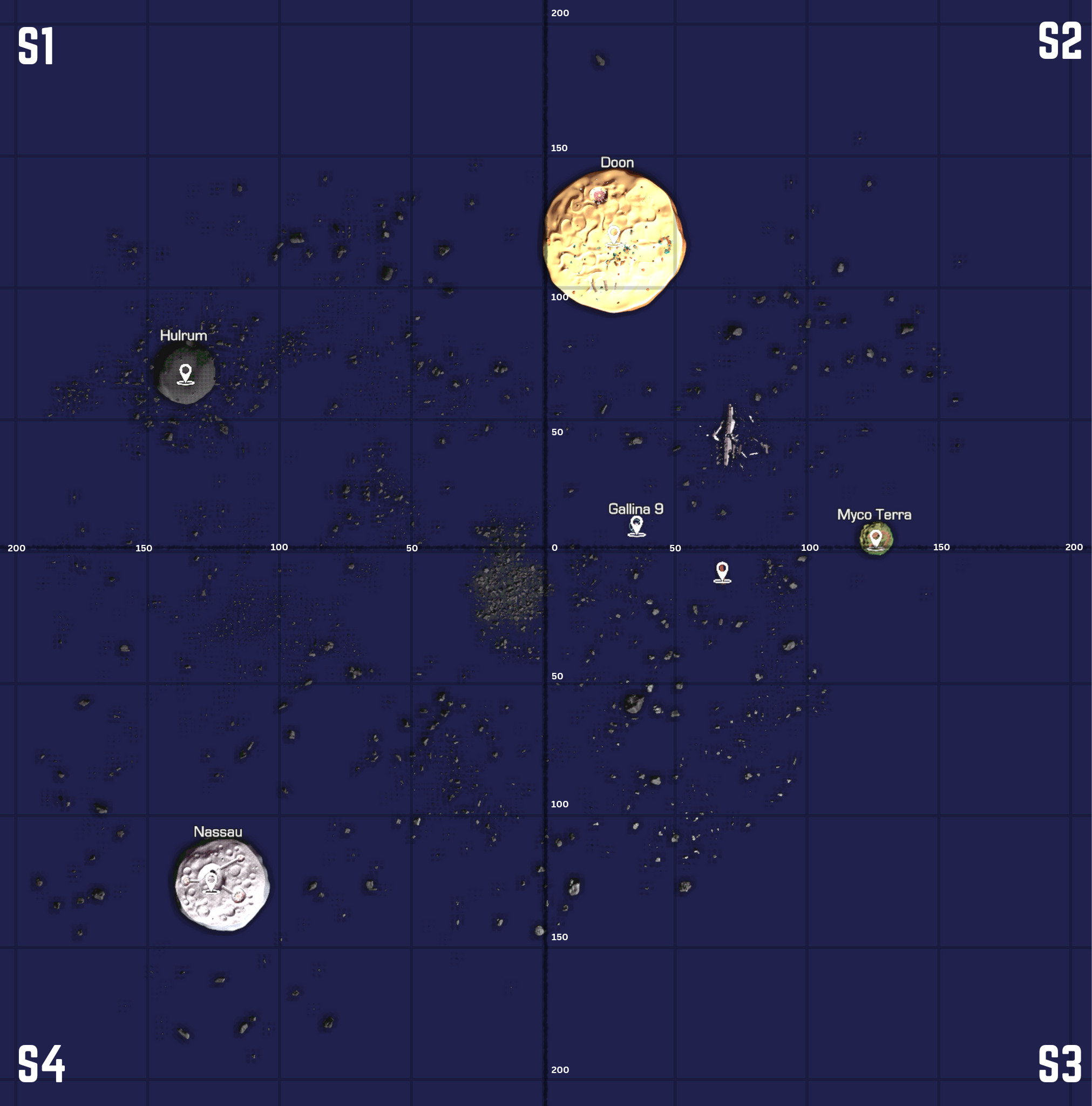
This is an interactive space sector map, with a grid for pin-point coordinates
during missions. Here's how you can read this graph:
"S1'140'75" will be the planet Hulrum. S1 just means sector 1, so the top left portion of the map.
140 is the X axis going LEFT, 75 is the Y axis going UP.
